


Voting District 0777930000004, Kalamazoo County, Michigan
About
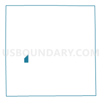
Outline

Summary
| Unique Area Identifier | 597164 |
| Name | Voting District 0777930000004 |
| County | Kalamazoo County |
| State | Michigan |
| Area (square miles) | 1.51 |
| Land Area (square miles) | 1.51 |
| Water Area (square miles) | 0.00 |
| % of Land Area | 100.00 |
| % of Water Area | 0.00 |
| Latitude of the Internal Point | 42.21250410 |
| Longtitude of the Internal Point | -85.65680000 |
Maps


Graphs
Select a template below for downloading or customizing gragh for Voting District 0777930000004, Kalamazoo County, Michigan


Neighbors
Neighoring Voting District (by Name) Neighboring Voting District on the Map
- Voting District 0776556000011, Kalamazoo County, MI
- Voting District 0776556000016, Kalamazoo County, MI
- Voting District 0777930000003, Kalamazoo County, MI
- Voting District 0777930000005, Kalamazoo County, MI